NASA
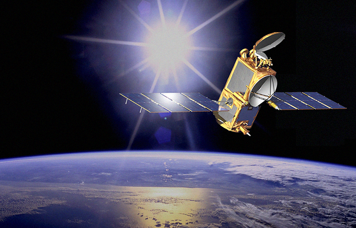
Satellite monitoring is no longer a sensation for many industries. Space is now an integral source of information that many spheres rely on heavily. And the collection of this data has become possible thanks to Earth observation satellites designed and developed with the purpose of our planet observation from orbit. Such satellites vary by their purpose of use too. There are spacecraft for military spying, meteorology, environmental monitoring, cartography, etc.
Currently, the most widely used are Earth-imaging satellites. Such spacecraft carry out remote sensing and take Earth images analogous to aerial photography. This enables a variety of different industries to track change and monitor the state of things remotely, just looking at satellite images and analyzing them. We have singled out some of the industries that benefit most from such satellite monitoring to show how exactly space data is used for the good of those.
Agriculture and Forestry
Easy access to both archive and most relevant satellite imagery has revolutionized farming by taking field monitoringto a new level. Such images can be analyzed and used to track crop health over the span of its cultivation, monitor soil state, make harvest predictions, map the field identifying the zones that need more fertilization, irrigation, etc. And information from meteorological satellites can be used to predict weather-related threats like drought or cold stress and plan irrigation based on accurate precipitation data.
As for forestry, satellite monitoring of large forest areas is currently the most effective, time-saving and inexpensive alternative to ground research. The importance of such monitoring lies in deforestation being one of the biggest causes of global carbon emissions.
Satellite imagery enables not only timely and precise detection of deforestation, but also allows for tracking the effectiveness of measures set to mitigate forest loss. On top of that, satellite pictures are most convenient for identifying deforestation in wild forests that are very hard to reach for ground surveying. Analyzing satellite images for a period of time, it’s much easier to detect changes in the forest cover caused by illegal logging, local regulations violations, forest fires, and other reasons to draw out the extent of the damage, come up with solutions, and monitor how these solutions work out.
Ultimately, satellite monitoring of deforestation plays a key part in slowing it down thanks to offering an unmatched level of transparency and accountability. Scientists, governments, and non-governmental organizations now have remote and easy access to all the necessary data at their disposal to track and act upon forest clearing.
There is currently a variety of digital tools designed specifically for deforestation. Such instruments apply different algorithms to satellite imagery with the purpose of detecting change in forest cover to identify the occurring deforestation. Besides, such tools are usually able to send out notifications and alerts to users in near real-time to ensure timely decision-making based on detected threats.
One of the most useful applications of satellite imagery in forest monitoring is during the dry season when the threat of forest fires is especially high. Technology can aid in identifying and monitoring the “hotspots” and receive alerts to react accordingly and prevent the fire or its spreading. Generally, leveraging the possibilities of satellite data in forest monitoring significantly enhances forest conservation management, helping to detect forest loss, take appropriate measures, and monitor their effectiveness.
Utility
Satellite technology has long been used by utility companies for efficiency improvement and adverse environmental impact reduction. Such companies utilize geographic information systems (GIS) mostly with the purpose of accurate assets monitoring and maintenance, infrastructure mapping, power lines management (vegetation control), wildfires monitoring, underground utilities monitoring, and renewable energy enhancement.
When it comes to power lines management, the issue utility companies face is vegetation growth. Under the influence of wind, disease, etc, trees or their limbs can fall onto power lines and cause equipment damage and the absence of service to thousands of customers. Monitoring vegetation via satellite pictures, utility companies can easily detect potential threats of that happening.
Another cause of power lines damage are wildfires that are becoming more frequent and severe each year. Satellite imagery can improve wildfires prevention and mitigation by helping utility companies to detect dry places or hotspots that may result in fire to spot the threat beforehand.
Satellite data is also useful for utility companies when it comes to underground utilities monitoring (electric, gas, water and wastewater lines). With the help of satellite images backed up by other accurate data, engineers can precisely map different underground lines and supporting structures prior to digging and construction, which significantly simplifies their work and time spent on it.
Environmental Monitoring
Satellite data provides critical information about the environment and climate change. It includes information on sea-level rise, forest loss, biodiversity loss, abnormal weather events, and more. Besides, analyzing all of this information allows for assessing the effect of climate change on different spheres to improve decision-making when interacting with natural resources.